|
||
|
|
Kilmore Quay is on the south coast of Wexford situated, 13 miles east
of Hook Head and 10.5 miles west of Rosslare Harbour.
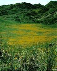
PKilmore Quay is a small fishing village with picturesque, thatched houses and a pretty harbour. Ballyteigue burrows stretch 9km / 5 miles west of the village and provide an interesting walk along the beach, in the 240ha of burrows or the 170 ha saltmarsh, which support Red Data Book protected flora and fauna. The area is designated a Special Protection Area (EU), Natural Heritage Area, Special Area of Conservation, Statutory Nature Reserve, CORINE Biotope Site, European Biogenetic Reserve, Area of Outstanding Landscape and Area of Landscape Importance. The site is also the wintering home to one third of Ireland’s visiting Bewick's swan in addition to: -
- Shelduck - Teal - Wigeon - Oystercatchers - Ringed plover - Golden plover - Grey plover - Lapwing - Knot - Dunlin - Black-tailed godwit - Bar-tailed godwit - Curlew - Redshank 3 miles offshore, lie the Saltee Islands, Ireland's largest bird sanctuaries for gulls, gannets, puffin and cormorants. It is possible to anchor off the islands or boat trips run from Kilmore Quay daily. The local seafood festival in July includes live music, dancing and lots of seafood.
iKilmore Quay harbour provides complete protection and has a 60-berth, secure marina with water, electricity and diesel available on the quay. There are 15 visitor berths. Kilmore Quay also has a chandlery, marine engineering service, lift out service, a Mersey Class Lifeboat, a supermarket, post office, a hotel, restaurants and a pub. òThe initial fix waypoint for a final approach: 52° 9.200' N, 006° 35.300' W - Kilmore Quay’s safe water mark (red and white buoy Iso 10s).
The harbour leading
marks are at 007.8° in-line (red and white pylons Oc White 4s) leading
to a 1.9m chart datum channel to the harbour’s southeast corner and
the 25m, east-facing entrance. The end of the west breakwater (QRG 7m, 5M green sector 354° to 003° leading to the harbour): 52° 10.230' N, 006° 35.190' W. Be aware of outlying rocks, strong currents, impact of strong SE winds and navigating fishing boats. On final approach, keep 25m off the western breakwater then turn hard to port for the entrance. The marina is in the northeast corner of the harbour LWS draught - 6.23 ft / 1.9m. Tide estimates: HW Cobh +0014 (+0019sp, +0009np) Direction of stream: Dover HW to +0500 west-southwest, Dover HW +0600 to -0100 east-northeast. Saltee Sound spring rate tides can reach 3.5kn with many eddies. Chart options: Admiralty Chart 2740 coves the Saltee Islands & Kilmore Quay at a scale of 1:25,000, Imray charts C57 / C61 or Discovery Ordinance Survey map 77.
Contacts · Kilmore Quay Harbour Master: Tel: +353 (0)53 9129955 E-mail: hmkilmorequay@eircom.net or VHF Ch 9 · RNLI, Kilmore Quay Tel: +353 (0)53 9129690 · Gardai (Police) Tel: +353 (0)53 9122333 · Customs: Tel: +353 (0)53 9133741 · Doctor: Tel: +353 (0)53 9135296 · Chemist: Tel: +353 (0)53 9135655
|
|